Quang Ngai is located in the Central key economic region; In an area with important national traffic routes and located adjacent to the Central Highlands region rich in development potential. As one of the gateways to the sea of the international trade corridor from the provinces of Southern Laos, Northeast Thailand and Northern Cambodia, it can be said that Quang Ngai is an important link in ensuring national security and defense and transportation. economic flow of the country.
Details of the regional planning of Quang Ngai province to 2020, with a vision to 2030 are fully and detailedly stated in the documents:
– Decision No. 190/QD-UBND of the Provincial People’s Committee approving the construction planning of Quang Ngai province until 2020, with an orientation to 2030
– Decision No. 136/QD-UBND of the Provincial People’s Committee on approving the transportation development planning of Quang Ngai province to 2020, with a vision to 2030
In this article, Sen Vang Group will summarize some highlights so that readers can quickly grasp the overview of Quang Ngai province’s regional planning to 2020, with an orientation to 2030.
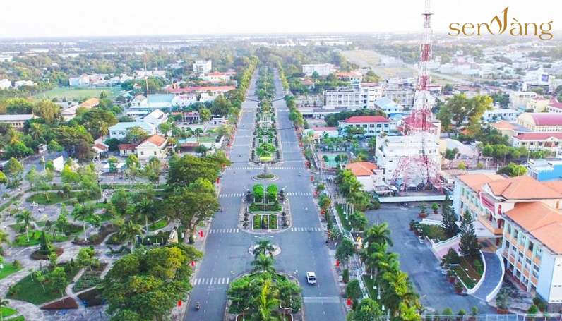
A corner of Quang Ngai City (Source: compiled by Sen Vang)
Planning goals
Based on the advantages of geographical location, economic position and available development resources, the regional planning of Quang Ngai province to 2020, with a vision to 2030, is in accordance with the goal of developing the province to become fundamentally better. into a modern industrial province. Priority is given to industrial development, especially petrochemical refining and supporting industries, at the same time as marine economic development, with a focus on maritime industry, seaport services and water exploitation. , seafood.
Research scope
The regional construction planning of Quang Ngai province is researched on the basis of regional linkage according to the Construction Planning of the Central Key Economic Region, including 5 provinces and cities: Thua Thien Hue, Da Nang, Quang Nam, Quang Ngai, Binh Dinh and the influence and interaction of Quang Ngai province with provinces in the Central Highlands region.
The scope of planning is the entire administrative management boundary of Quang Ngai province with a total natural area of 5,152.95km², with 14 affiliated administrative units, including Quang Ngai city and 13 districts: Binh Son, Son Tinh, Tu Nghia, Nghia Hanh, Mo Duc, Duc Pho, Tra Bong, Tay Tra, Son Ha, Son Tay, Minh Long, Ba To, Ly Son.
Highlights in the planning of Quang Ngai province
1. Orientation for spatial development
The main development model of the region is integrated economic development: industry, high technology, cultural – ecological tourism, trade – services, education and training and agriculture – forestry – fishery revolving around nuclear urban areas at regional, provincial level, and specific urban areas.
The province’s main economic development corridor is formed along key traffic routes: Da Nang – Quang Ngai Expressway, National Highway 1, National Highway 24, National Highway 24B, Dung Quat – Sa Huynh coastal road.
By 2030, the whole province will have 21 urban areas, 01 class II urban area (Quang Ngai City), 01 class III urban area (Dung Quat), 03 class IV urban areas (Duc Pho, Chau O, Di Lang) and 16 class V urban areas (district capital towns, district towns and new urban areas).
In particular, the spatial development orientation of Quang Ngai City includes the following areas: the existing southern urban center; Expanded existing urban area; New urban center in the North; Northern suburban areas; Northern riverside residential strip; Northern rural residential areas; Tinh Khe coastal residential area; Tinh Ky coastal residential area; Southern rural residential area; Nghia An coastal residential area; Tra Khuc River and riverside islands: Hon Ngoc Island.

Spatial development orientation of Quang Ngai City (Source: compiled by Sen Vang)
2. Land use planning
Land use structure of Quang Ngai province by 2021, mostly agricultural land, accounting for 88.34% of the province’s land area. Among agricultural land, forestry land and production forest land are the two types of land with the largest area. The area of non-agricultural land is low at 10.97%, mainly specialized land. Unused land accounts for 0.71%, mainly unused hill land.
Quang Ngai province’s land use planning until 2025 reduces the agricultural land area to 76.05%; Non-agricultural land remains 10.69%; Economic zone land is 7.66%; Urban land is 4.99% and 0.60% is unused land.
Oriented to 2030, the agricultural land area will decrease to 74.56%; Non-agricultural land increased to 11.73%; 7.60% economic zone land; Urban land increased to 5.50% and 0.60% was unused land.
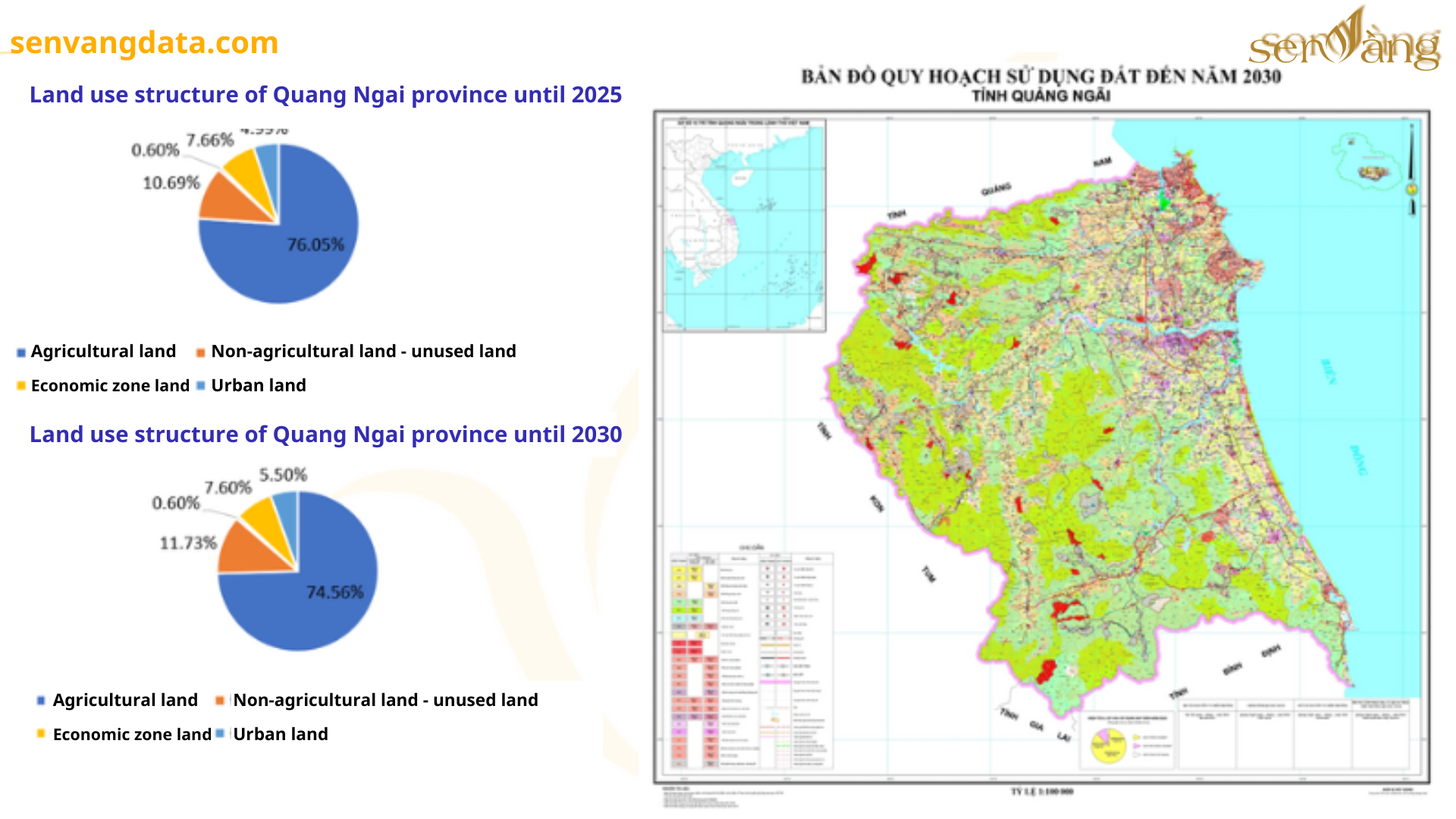
Land use structure of Quang Ngai province (Source: Compiled by Sen Vang)
3. Transportation infrastructure
3.1. Road
The road traffic system of Quang Ngai province currently has main roads running through it including: National Highway 1; National Highway 24A; National Highway 24B; Dung Quat – Sa Huynh coastal road.
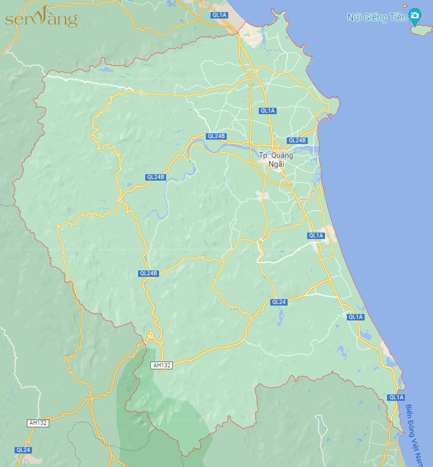
Road traffic map of Quang Ngai province (Source: compiled by Vang Sen)
Quang Ngai province advocates investing in developing a sustainable, synchronous and reasonable transportation system. In particular, focus on building and upgrading main axes as a driving force to promote socio-economic development for some regions; Linking the province’s transportation network with the national transportation network.
Along the vertical axis are roads running along the length of the province, the starting point starting from the Quang Nam border, ending at the Binh Dinh border and parallel to National Highway 1, upgraded and adjusted additionally.
Along the horizontal axis are the routes running across National Highway 1, starting from the coastal route to the mountainous vertical axis and continuing to Quang Nam, Kon Tum province and connecting to Laos.
Organize the opening of routes from Quang Ngai city to Lao provinces and from Quang Ngai city to the Northwest provinces. Reorganize transport properly on a number of routes currently in operation from Quang Ngai to the southern provinces and the Mekong Delta.
3.2. Rail
Renovate and upgrade the railway section through Quang Ngai province, completing the national railway connection with Dung Quat Economic Zone. Upgrading and renovating passenger stations (waiting rooms, passenger welcome houses…), cargo stations (warehouses, loading yards, loading and unloading roads…) of Quang Ngai station, Duc Pho station and stations in districts Modern and comfortable guaranteed.
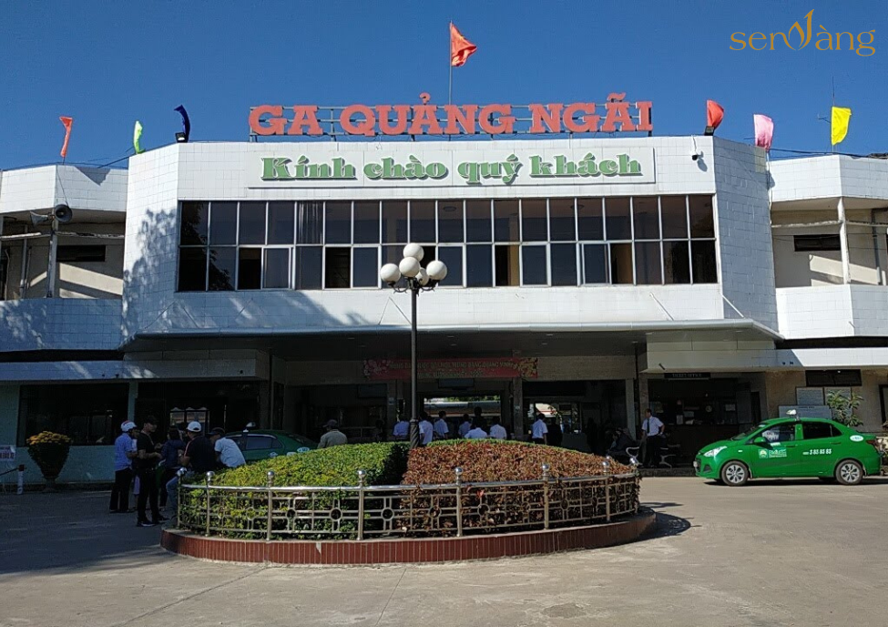
Quang Ngai Station (Source: compiled by Sen Vang)
3.3. Waterway
Construction planning of Quang Ngai province until 2020, orientation to 2030, the policy of investing in upgrading and completing deep-water ports of Dung Quat, Dung Quat II, Sa Ky port and small ports are planned to meet the needs of Quang Ngai province. Local coastal transport bridges – including ports: Co Luy (general), Ben Dinh – Ly Son (fishing + passenger port), Sa Huynh (fishing port), Ly Son military port (ship landing port) , My A (general port).
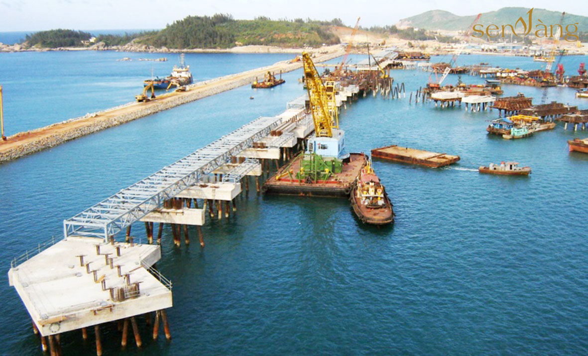
A corner of Dung Quat seaport (Source: compiled by Sen Vang)
Planning of Dung Quat wharf area within the land and water areas of Dung Quat bay and Tra Bong estuary area. The planning ensures the function of directly serving Dung Quat economic zone, metallurgical industrial complex, petrochemical refinery, Central region electricity and gas center and surrounding areas; There are general, container, bulk, and liquid/gas cargo terminals; Ports and works serving new ship building and repair facilities.
4. Key project
4.1. Dung Quat economic zone
The planned boundary of Dung Quat economic zone has an area of about 45,332 hectares; East sea bordering the east; The West borders the North-South railway; The south borders Quang Ngai city; The North borders Quang Nam province.
Organize functional areas in economic zones until 2035, focusing on developing the space of industrial parks and warehouses; space for seaport development and support service areas; tourism development space – green space; space for agricultural and forestry development; urban and rural development space.
In which, focusing on developing industrial parks of West Dung Quat, East Dung Quat, Tinh Phong Industrial Park and Binh Hoa – Binh Phuoc Industrial Park; Consider, review and adjust the planning of Dung Quat II Industrial Park and Dung Quat II port.
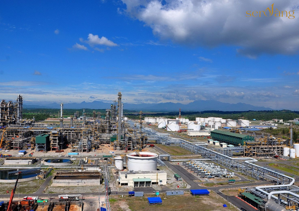
Dung Quat oil refinery is located in Dung Quat Economic Zone (Source: compiled by Sen Vang)
4.4. VSIP Quang Ngai Industrial – Urban and Service Park
VSIP Quang Ngai Industrial – Urban and Service Park is located in Tinh Phong and Tinh Tho communes, Son Tinh district, in Dung Quat Economic Zone, Quang Ngai province, and construction started in 2013.
The project has a planned area of 1,700 hectares, of which the Industrial Park is 1,143 hectares and the Urban Service Area is 554 hectares.

KVSIP industrial park Quang Ngai (Source: compiled by Sen Vang)
VSIP Quang Ngai Industrial Park has attracted 14 domestic and foreign investors with a total investment capital of nearly 240 million USD. There are currently 7 FDI projects in operation, attracting about 3,400 local workers and significantly contributing to the industrialization and urbanization process in Quang Ngai.
4.3. Nghia Ha new urban area
Nghia Ha new urban area has an area of about 62.38ha in Nghia Dung commune (7.58ha) and Nghia Ha commune (54.8ha), Quang Ngai city; The East borders the existing residential area of Nghia Ha commune; The West borders the existing residential area of Nghia Dung commune and land for growing crops; The South borders Provincial Road DT.623C and Nghia Ha residential area; The North borders Truong Sa Road.
This is an urban area facing the southern bank of Tra Khuc River, including basic functional areas such as the provincial sports complex, commercial services, green park – water surface; invested in a synchronous technical infrastructure system, meeting the needs of training, sports competitions at the provincial level, and the needs of commercial and residential services for the people of Quang Ngai city, creating a driving force for development for the province. area and surrounding area.
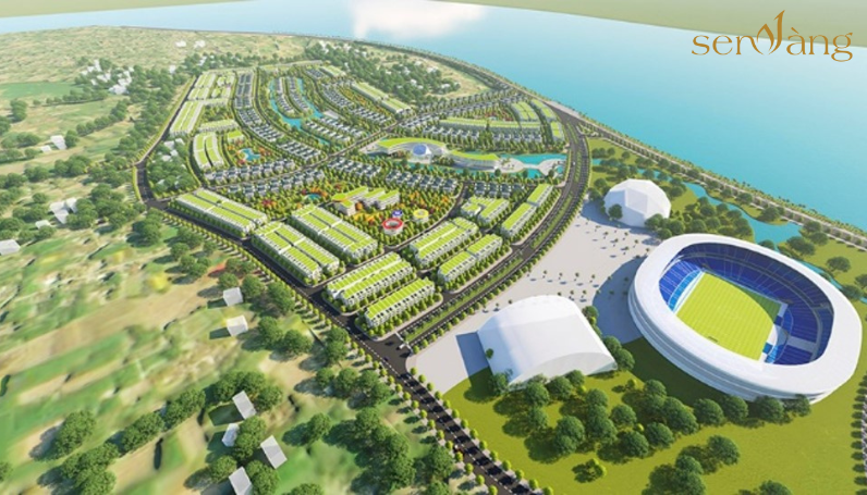
Perspective of Nghia Ha New Urban Area (Source: Sen Vang compiled)
|
Above is general information about “Construction planning for Quang Ngai province until 2020, orientation to 2030” Provided by Sen Vang Group. Hopefully the above information will help developers, investors and real estate businesses have an overview of investment efficiency and the policy of linking black areas back to the. In addition, to see more articles about the Mekong Delta region, readers can visit the website senvangdata.com. |
Source: Summary of Sen Vang Group
Contact Info:
Website: https://senvangacademy.com/
Hotline: 0948.48.48.59


Copyright © 2022 Copyright belongs to SEN VANG GROUP